YOU WILL BE AMAZED!
(You might want to print this page before proceeding!)
Learn How to use Google Map on the Street level
A Picture is Worth a Thousand Words.
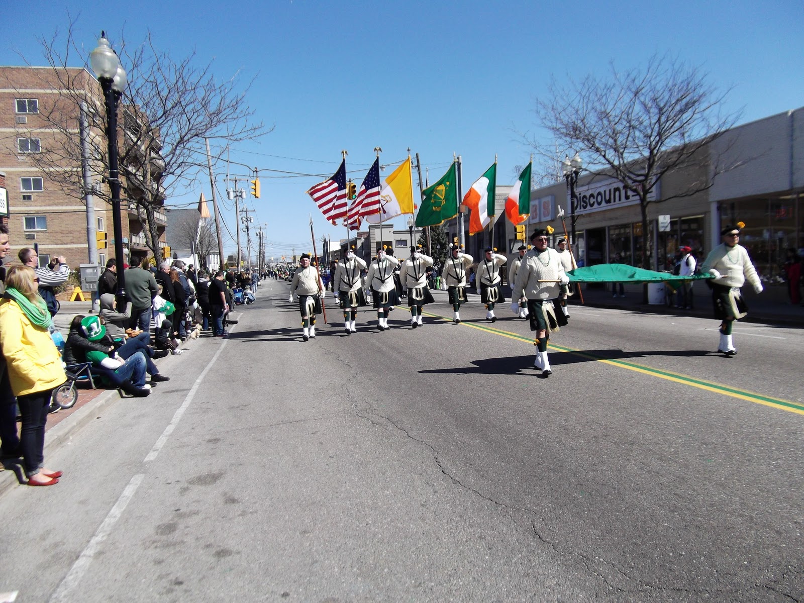
The photo below of Four Corners in Patchogue, NY was taken from Google Map.
Rather than bore you with words, lets go into "
Quick Start Mode."
1 Open Microsoft Internet Explorer (browser).
2. Type "www.google.com" in the URL Box (no quotes).
3. Once in Google, Left Click (LC) the word "Maps."
4. In the Box that is next to the text that says "Google Maps," type a street address such as: "1 south ocean avenue, patchogue, ny" (do not type the quotes), and Press the enter key.
5. You will now be looking at a map of Patchogue, with the letter "A" located at "1 South Ocean Ave, Patchogue, NY. "OK THAT'S NICE! Now what!"
6. In the upper Left Hand Corner of the Map, you will see an icon of a Man, just above the "Plus and Minus Signs. Position the "Mouse Arrow" on top of the Icon of the "Man." Hold down the Left Mouse Button, and drag the icon of the man, onto the address 1, South Ocean avenue, and release the mouse button. (NOTE The small circle below the Man Icon is the actual area that will be viewed. (only streets that turn Blue on the map can be viewed)
7. You should now be looking at Photo of "Four Corners," in Patchogue, NY. (See the Screen Capture Photo below.)
8. You can now place your "Mouse arrow" on the Photo and drag it around by holding down the Left Mouse Button. You can look around the street 360 degrees by dragging the photo.
9.
While moving your Mouse around the photo of Four Corners, you will see a "CIRCLE" along the road; if you Double Left Click the "Circle" the photo will view from that new location. You can literally walk up and down Main Street by double clicking the circles.
10. The Wheel on your Mouse is used to "zoom in and out." If you zoom too far out you will once again arrive at the Map, not the Photo!
I used this tool before going on vacation to Hawaii, to familiarize myself with the roads of Oahu. This tool helped to make my vacation "stress free." While driving through Oahu, I was thoroughly familiar with roads and venues that would otherwise have been totally foreign to me.
If this is handy please forward this Blog link to your friends.
Problems? Use the comments box below.
(Left click photo to make it larger)
Questions or Comments?
Click "Comments {below}," then Click "Anonymous."
*
Type your message, and then click "Publish Your Post."
*
Our Thanks to Google For Hosting Our Site. Also!
Our Thanks to the "Gang," at Blogger for designing this program!